|
5/27/2022 0 Comments Virginia to the last mileDay 15: Damascus to Bristol, 30 miles
Day 16: Rest day in Bristol VA/TN
Day 17: Bristol VA to Gate City VA, 25 miles
Day 18: Gate City to Jonesville, 37 miles
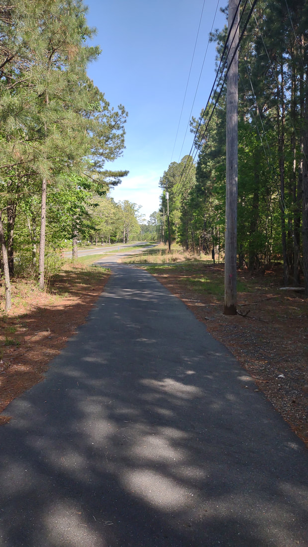
Day 19: Jonesville VA to Middlesboro KY, 39 miles
A sign on the historic Cumberland Gap trail reads: Salt seeking buffalo Moccasin clad warriors Dreaming pioneer Battling Civil War soldiers Each was here in the Historic Cumberland Gap and now so are you This is the Historic Cumberland Gap "Land exists in context, and that context is often complicated. I have been granted passage through a place that has a history and a future." - Laura Killingbeck from an Instagram post about her hike on the Florida Trail that I'm applying to me biking through the Cumberland Gap Pretty awe inspiring, isn't it?
0 Comments
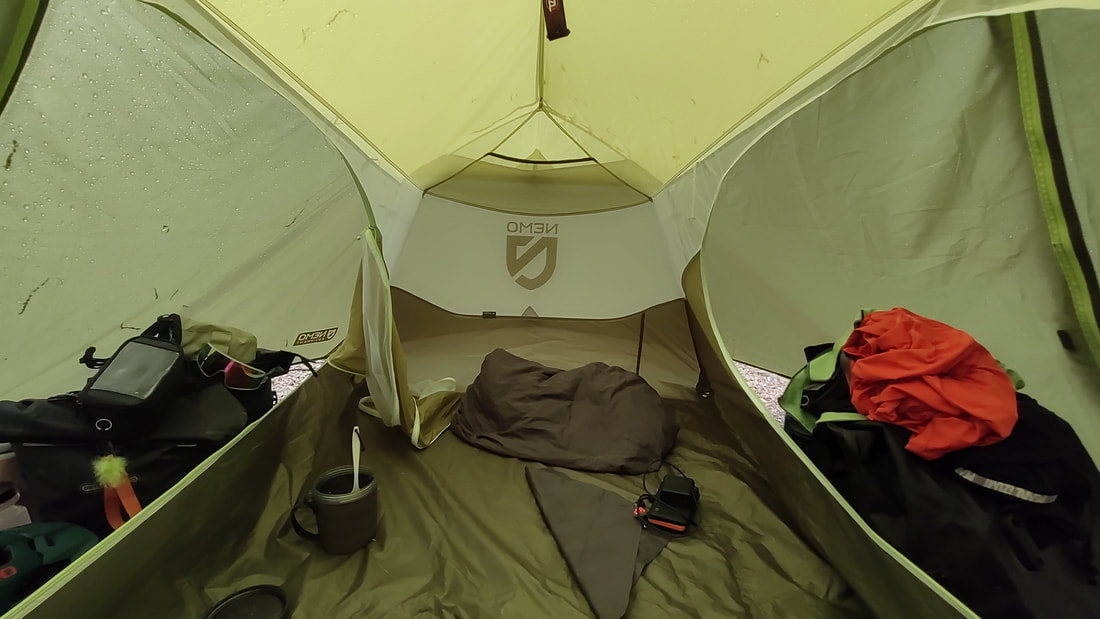
5/20/2022 0 Comments There's no Raining on my paradeDay 11: Meadows of Dan Campground to Fancy Gap Cabins and Campground, 20 miles. Woke up refreshed after the thunderstorm and rain, eager to get on the road. A nice lady from an adjoining site took a photo of me before I left my site - I had learned the night before that her son had completed multiple long distance bike tours! The first thing I noticed as I started pedaling was an odd sensation in my left knee. It turns out that sensation was that it didn't hurt to pedal anymore! All the stretching I was doing in the evenings before going to bed, more stretching as I was in my tent, and more before I even get out of my sleeping bag in the morning helped - not to mention, every time I've been on the phone with Hailley I stretch my legs! My knee not hurting was my cue that I could upp the pressure, yet take it easy at the same time. I got on the Blue Ridge Parkway, and it was an amazing road. It's not called the Blue Ridge Parkway for nothin'! Within 5 minutes of being on the parkway I stop to talk to 2 other cyclists who were biking the entirety of the Parkway. Those two would be the only other cyclists I'd see on my two days of biking on the Parkway. While on the parkway, there were huge old growth White Pines and the views! Compared to the previous days, this ride was essentially flat. There were no giant hills, it was all do-able. [it's all, do-able, even highway 58 to Lovers Leap, my legs are just getting stronger] About halfway to Fancy Gap is Groundhog Hill. The parkway and all the pull offs are managed by the National Park Service. Everything on the Parkway is supposed to open on May 1, but as I talk to locals it sounds like it rarely opens on that day. And with my luck, Groundhog Hill rest stop wasn't open, but I pushed my bike around the gate to see the view anyways. There was absolutely no way that I was going to bike past it and NOT see the view. The water was shut off and bathrooms closed, and that was fine with me. I just needed a spot to stretch, eat a snack, and drink water in the shade. The view: awesome. I'm so glad I didn't skip it. My next stop was a convenience store in the town of Fancy Gap to get more food - variety of Clif bars, protein bars, Chex mix, tuna, ravioli, and peaches. And then I was on my way to the campground, where I arrived around 1 or 2pm - a lot quicker than I was expecting. My parents had offered to pay for the night of camping, and said that I could upgrade to a cabin if I wanted when I arrived. I took them up on their offer of the cabin, always accept the bed! Thanks, Mom & Dad! The cabin was so frickin cute. It was just a small one room building with a bed, futon, mini fridge, microwave, and coffee pot. Bike tourists get trail magic too - the couple in the cabin next to me offered me pizza and a cold bottle of water. Much appreciated snack before I cooked my dinner of Mac n cheese and planned out my route for the next couple of days. Day 12: Fancy Gap Cabins & Campground to New River Bridge Family Campground, 23 miles. If I thought my legs felt good the previous day, they felt awesome on my way to the New River campground. I was absolutely flying. This served as a stark reminder to pace myself, as a bike ride across the United States is a marathon, not a sprint & as people keep reminding me, I will make up time on flat middle-america. En route, I stopped at a Dollar General in Galax and picked up loaded instant potatoes, salmon packet, ranch tuna, chocolate almonds, and trail mix. Personally, I don't mind carrying extra food in my bear canister. With large stretches of road that I ride on without seeing stores, I'd rather make sure I have enough food for [somewhat] adequate meals. I also stopped at the Galax Public Library. It was a very new and well maintained library. I had brought my paper map of VA inside and asked the library ladies for road recommendations for the next few days and they got me all squared away. This campground was on the New River - which flows north! (That was the campground owner's fun fact about the river) The New River was so neat, and as we were in the mountains, it formed a valley that offered an amazing view of the river and vertical cliffs. I knew I had to get into the river, so I waded out and teetered on slippery rocks to give my legs some cold water therapy. There was little to no cell service in the valley, and perched precariously on a lamp post I had one intermittent bar of service. After my dinner of loaded instant mashed potatoes and a ranch tuna packet, I stood by the river and watched branches float by - I saw the coolest animal - an absolute GIANT snapping turtle. Bigger than any I've seen in Michigan. That was the highlight of my day. Day 13: New River Bridge Family Campground to Troutdale AT Hiker's & TransAm Cyclist Hostel, 30 miles. Breakfast of champions consisted of: trail mix (almonds, cashews, raisins, pumpkin seeds, peanuts, cherries, craisins), cheddar whales, an oatmeal packet, scoop of vegan protein powder, and water mixed in a Chex mix bag. I'm pleased to report that this concoction tasted better than what it sounds. Food will surprise you when you're hungry! According to the weather forecast, this was supposed to be the first day of many of rain/thunderstorms. Luckily enough for me, the rain started at 5am and ended at 7am, so by the time I was on the road it was only overcast. The terrain was surprisingly equal in the descents and climbs. For part of my ride, highway 58 snaked alongside the New River with a gentle downhill slope, where it was easy to cruise on a higher gear. That didn't last for long though. Through Mouth of Wilson, Volney, and then the final push to Troutdale was more uphill than down. The only way west is up! By going through Troutdale, I had chosen to take the northern route around Mt Rogers. (more on that later!) I was successful, I had reached the hostel before the predicted thunderstorms in the afternoon. There was only one other person staying there, a north-bound AT hiker. The hostel consisted of two separate rooms, both with 4 bunks, folding chairs, and a desk. I placed my items in the room that wasn't being occupied. We chatted as I dried my tent in the sun, ate a snack, and journaled. Troutdale, as it was in the middle of nowhere, had no cell service. Once again, not a big deal if I was driving or biking with someone else. However, that meant I had no access to how severe the thunderstorm would be. I incessantly texted through my Garmin (when needed, I can connect my GPS to my phone & text through Garmin and satellite) asking about the weather of the next day. The hiker was absolutely projecting his own fears about the weather onto me (ie: he was older, white, male, had a know-it-all persona) and I did my best to ignore him. I know and trust my biking abilities. I know what weather I personally can bike or not bike in. I know I WilL not melt with a little bit of rain, and I have a blind stupid trust in my red and white flashy lights, reflective markings on my panniers, & my yellow raincoat. Day 14: Troutdale AT Hiker's & TransAm Cyclist Hostel to The Place Church Hostel in Damascus, 24 miles. Yes, I absolutely did ride the day in the rain. Look, I survived! The whole day was a heavy mist - so really, it wasn't that bad. My panniers are waterproof, I'm wearing rain pants and a rain jacket, all is golden. Additionally, to Damascus it is roughly 80% downhill. However, rain + descent = more slippery roads. Everything, as it always does, worked out. I passed cows grazing on Mt Rogers (and I later learned that there's wild horses on the mountain!). I slowed down to let trail runners in a race cross the road - that's hardcore - running in actual mountains! On my descent to Damascus I had multiple bike rental vans and trailers pass me going up the mountain, and then returning to the rental location. The Virginia Creeper Trail runs through Damascus, it's a popular gravel trail for bikes and walking. I did not and still would not trust my tires on it. Just by the bike rental vans, I was getting the vibe that Damascus was more outdoorsy. I did not look up why it was outdoorsy before arriving, but I quickly found out that it was because it was an Appalachian Trail & official Trans-America bike route town. I stopped at the first bike rental place I saw, to ask if they could look at my bike to see if it would fall apart in the next 50 miles. The answer was no. However, my brake pads were in dire shape and the shop owner was nice enough to show me exactly online the brake pads I needed for my bike. I set a reminder on my phone to order them on Monday. So far on my trip, I had been the most outdoorsy person I had seen, and the only people I've talked to that were my age were friends and family I've called in the evening. Not gonna lie, the thought of interacting with equally outdoorsy & crazy 20-something year olds was intimidating. I also managed to not eat or drink enough on the ride - it was cooler and I simply *forgot*. I allowed myself a big girl cry for 10 minutes and then put my butt into gear to Dollar General to get a couple more meals & to find a hostel to stay at. The first hostel was already full by noon, so I found a different one that 'opened' at 3pm, so I waited in a pavilion out of the constant rain. 3pm rolls around and I get a bunk & the caretaker goes over the rules of the establishment. Thru hikers and long distance cyclists are both crazy. Different strands of crazy. Both doing an incredible feat consisting of insane distances on the human body. I was the only distance cyclist that I saw in Damascus, and the only cyclist in the hostel for the night. I was the odd man out. All questions pointed at me because I had a bike rather than walking!! What took me a day to bike from Troutdale, would take them 4-5 days. We had more in common than differences - similar food, sleep systems, cookstoves, water filtration, etc. I had nothing to be intimidated by, and they even invited me to hike the AT with them after I reached Oregon :) 5/10/2022 0 Comments Exercises in TrustTangible and non-tangible things you gotta trust while biking 24/7:
Day 8: Gretna to Rocky Mount, 36 miles. Threatened rain and thunderstorms all day, on the slightly humid-chilly side with such an intense fog that I put on my yellow raincoat so drivers were more likely to see me. Wore my blue Iceman Cometh MTB socks for extra good luck and motivation. Fog and rolling hills allllllll day, however my legs were rejuvenated from the rest day. Planning to stealth camp at another church, I stopped at a Lowe's to stretch, use the wifi, and walk around. In Lowe's, I could hear either thunder, or Lowe's moving stuff around - ya know, that booming noise. Less than 10 minutes later the sky opens up and it's a complete downpour. I hop on my bike to ride to a church to stealth camp. I start for this church, and i come to realize that it's up a verY BIG HILL that was not evident on google maps. I am in a predicament. It's Sunday, so nothing is open, and I'm riding around close to a breakdown. I came across a generous couple, Wayne & Joan, who let me crash in their extra bedroom, bought pizza for dinner, and fed me eggs and bacon in the morning. I am even more thankful of my stay with Wayne and Joan, because they were able to look at my planned route for the next days and inform me on the status of the roads. On a couple of the roads I had planned to go on had looooong stretches of no cell service, no homes, and definitely no where to refill water - if I had been biking with a friend, this wouldn't have been so much of an issue, but due to traveling solo I'd rather err on the side of caution. Day 9: Rocky Mount to Fairy Stone State Park, 30 miles. Temps back in the mid 80s, TOASTY. Toasty Eryn needs to take more breaks and drink more water. I filled my CamelBak twice and drank two bottles of water with electrolytes. Hills, but more downhill than the previous days, don't know how to explain it except for that. Thought of the lake at the State Park the whole ride. The State Park was up on the side of the mountain. A steep final push to the campground after a long, hot day. It was awesome to see the rock formations on the side of the road, I was traveling south to FSSP, and the rocks were all pointing north/north-west! The actual campground was a half mile walk from the lake. Not gonna lie, the mile round trip walk to the lake wasn't really worth it - however the water did feel good on my legs. Fairy Stones are to this area as agates are to the Lake Superior shoreline, yet they have a mythical story attached. I don't feel like butchering the story of the Fairy Stones, so you can look that up! Here's a snippet poem from a brochure I saved: Through the days of labor and the nights of rest may the charms of the fairy stone make you blessed. Where ever you stay, where ever you go, may the beautiful flowers of the good fairies grow. Day 10: Fairy Stone State Park to Meadows of Dan Campground, 25 miles. Temps in the 80s again. This time I'm prepared, when I fill up my water bottles I dampen a bandana to put around my neck to cool down. My left knee hurt again this ride. I stretched at every opportunity. Everything was basically downhill except highway 58. Highway 58 was straight up the mountain. Look at a map for this next part if you aren't already. From the intersection at highway 8 & 58, it's 5 miles to Lovers Leap @ 3,300ft. Not gonna lie, I made it pedaling probably .75-1 mile before walking the rest of the way to Lovers Leap. No shame in my walking game. I switched to my chacos so I wouldn't ruin my clips and walk the 4 miles to Lovers Leap. This overlook was gorgeous. I just about cried. After being in awe of the view, I continued on to the campground. I stopped at The Poor Farmer's Farm Country Store to fill up my CamelBak. Hunger and delusion brought me to their deli counter, where I chatted and ordered a sandwich - the number 1 Hillbilly Sandwich - I don't remember the exact sandwich name, but I know it had Hillbilly in it LOL. Salami, bologna, 2 types of cheese, lettuce, & sauteed onions on buttered and toasted bread. It was great and just what I needed to bike the remainder of the miles to the Meadows of Dan campground. Sometimes (*ahem, most times*) I don't realize how much I need to eat until I actually do eat. The Meadows of Dan Campground is a small private campground next to the Blue Ridge Parkway, a cute lil place. The lady who owned the place was worried about hungry bears and had me place all my smelly items in the laundry room. A thunderstorm raged at dusk that shook the meadow. Lightning lit up the sky and my tent. I know the legend of Paul Bunyan doesn't have anything to do with the weather, however my thoughts during this thunderstorm was that he was hitting pots together so hard to create thunder and lightning. 5/6/2022 0 Comments Days 4-7Day 4: Pocahontas State Park to Twin Lakes State Park. This day was an adventure. I started out the morning and realized that I only had access to calling texting on my phone - Google maps wasn't showing my blue dot. As most people aren't up by 7am, I texted my friends until someone answered. A friend, Hailley, so kindly was my eyes and ears on the road this day and texted me mileage updates along with every road to take to my campsite. Thanks a million, Hailley! This was a longer day - roughly 53 miles. The terrain wasn't too rough, but the temperature + busy road + most miles in one push ride this year took a toll. Additionally, Virginia State Parks close their campground offices at 4pm! So early! I rolled in at 4:30 without a reservation, talked to the camp host, and got a site. Day 5: Twin Lakes State Park to a church in Phenix, 35 miles. Stealth camped completely out of view of the road. More rolling hills, starting to see more farms and cows! Biking temps in the mid 60s. Great weather, but not gonna lie, after the 80 degree days it was a little chilly! The temps at night dropped to 37/40ish - a tad chilly at night even for me! Biked more on back roads rather than bigger highways. Day 6: That church ^ to another church in Gretna, 39 miles. Mid 60s temps again. More hills than the previous day and they left me with tired legs (to be expected after riding all week!!). Left knee starts to hurt when pedaling. Sort of a bigger town, so I walked around Food Lion, used their wifi and restocked my food supply. Moved on to buying fries from McDonald's and soaking up their wifi and electrical outlet before heading to my camping spot for the night. Day 7: Rest day in Gretna, at a the Gretna Motel. Just a little Mom & Pop place - nothing fancy. But it was a bed and just about anything is comfy compared to my yoga mat of a sleeping pad, and I was out of the elements. I washed some of my clothes in the sink, took a hot shower, napped, planned out buying more food, and talked to friends and family on the phone. 6 days on the bike and over 200 miles is great progress and completely warranted for a day off. My body and my mind was grateful for a rest day. 5/3/2022 0 Comments First few days in Virginia
|